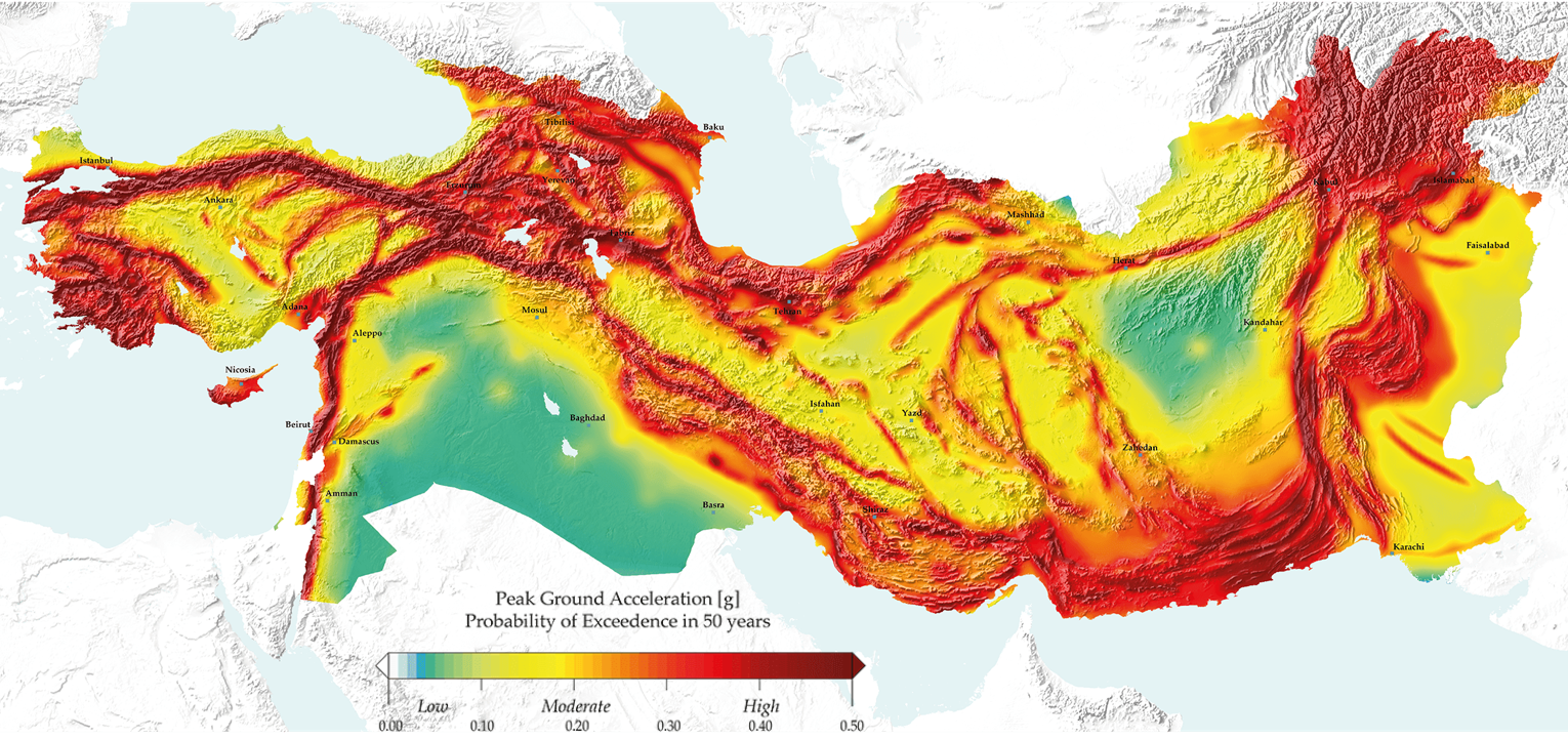
The 2014 Earthquake Model of the Middle East (EMME14) is the latest seismic hazard model, developed within the Earthquake Model of the Middle East (EMME) Project between 2010 and 2014. The model spans across region across eleven countries: Afghanistan, Armenia, Azerbaijan, Cyprus, Georgia, Iran, Jordan, Lebanon, Pakistan, Syria and Turkey. This region is one of the most seismically active regions on Earth because of complex interactions between four major tectonic plates i.e., Africa, Eurasia, Arabia and India and one minor tectonic block - Anatolia. Destructive earthquakes frequently occur within this region with great loss of life and properties, as shown by major earthquake disasters in modern human history 1939 Erzincan (Turkey), 1988 Spitak (Armenia), 1990 Manjil (Iran), Izmit (Turkey, 1999), Bam (Iran, 2003), Kashmir (Pakistan, 2005),Van (Turkey, 2011), and Hindu Kush (Afghanistan, 2015).
Reference Seismic Hazard Map of Middle East depicting PGA levels with 10% probability of exceedance in 50 years (Giardini et al 2016)